
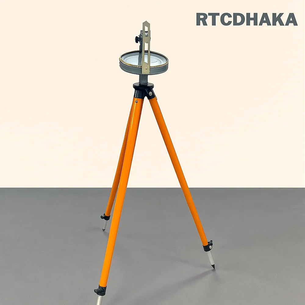

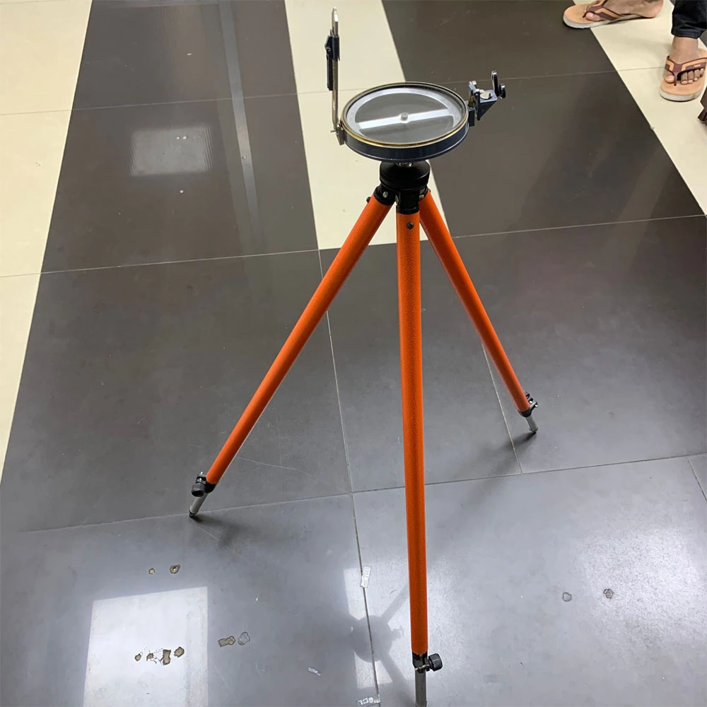
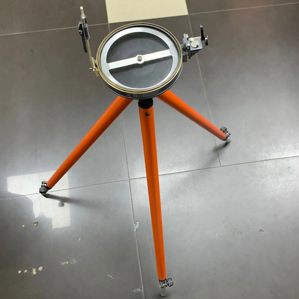
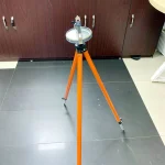

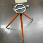
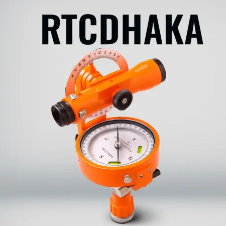
Prismatic Compass for land surveying
Prismatic Compass
- Size: stander
- Manufacturing Country: India
- Importer: Rahim trading corporation
Accessories:
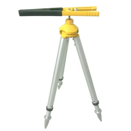
- One Best Quality Prismatic Compass
- One 5-meter tripod Best Quality.
- one colorfully Oven bag
আপনার পন্য বুঝে নেওয়ার আগে প্রয়োজনী সব কিছু বুঝে নিন
Original price was: ৳ 15,000.৳ 13,500Current price is: ৳ 13,500.
🔷 Prismatic Compass for Land Surveying
Prismatic Compass for Land Surveying is a reliable and widely used surveying instrument designed for accurate measurement of horizontal angles and bearings. It is commonly applied in land surveying, forestry surveying, route surveys, and preliminary construction work where precision and portability are essential.
This prismatic compass allows surveyors to take direct readings while sighting an object, which improves efficiency and accuracy in the field. Because of its compact design and sturdy construction, it is suitable for both professional surveyors and academic training purposes.
🔷 Key Features of Prismatic Compass
- High-accuracy magnetic bearing measurement
- Clear prism for easy and quick reading
- Durable metal body suitable for field conditions
- Lightweight and portable design
- Smooth sighting vane for precise alignment
🔷 Applications
The prismatic compass for land surveying is commonly used in:
- Boundary and plot surveys
- Forestry and environmental surveys
- Road and route alignment surveys
- Educational and training institutes
- Preliminary engineering surveys
For advanced surveying tasks, you may also explore our
👉 Internal link: https://rtcdhaka.com/product/total-station
🔷 Why Choose This Surveying Compass?
Compared to ordinary magnetic compasses, this instrument offers better accuracy and faster readings. Moreover, it is an excellent choice for surveyors who require a dependable tool without complex setup. Therefore, it remains a popular option in many surveying projects across Bangladesh.
For detailed technical background, you can read more here:
👉 Outbound link: https://en.wikipedia.org/wiki/Prismatic_compass
🔷 Product Summary
If you are looking for a dependable, easy-to-use, and professional-grade instrument, the Prismatic Compass for Land Surveying is an ideal solution. It combines accuracy, durability, and portability, making it suitable for a wide range of surveying applications.
Size Guide
Related Products
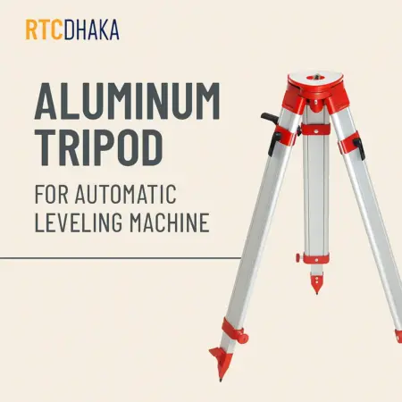
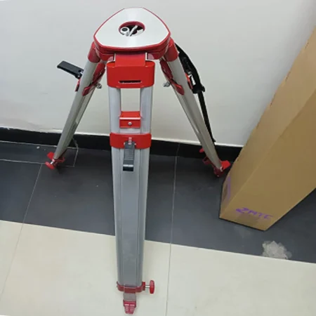
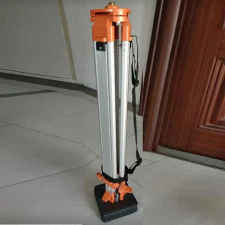
Aluminum Tripod for Automatic Leveling Machine হলো একটি উচ্চমানের সার্ভেয়িং টুল যা Theodolite, Auto Level এবং Laser Instrument এর সাথে ব্যবহার করা হয়। এটি মজবুত অ্যালুমিনিয়াম দিয়ে তৈরি হওয়ায় হালকা ও টেকসই। 3 মিটার পর্যন্ত এক্সটেনশন সুবিধা থাকায় এটি বিভিন্ন ফিল্ড সার্ভে কাজে ব্যবহারযোগ্য।
RTC Dhaka বাংলাদেশে এই ধরনের সার্ভেয়িং ইকুইপমেন্টের বিশ্বস্ত সরবরাহকারী।
90 in stock


Double Prism Optical Square
- Name : Double Prism
- Category : Optical Square
- Manufacturing Country : China
- Country of Origin : China
Prism Pole Holder / Mini Tripod
- used for maintaining the
- highest accuracy of total station.
- Made in: China
-
Prismatic Compass
- Customized support: OEM, ODM, OBM
- Place of Origin: Heilongjiang, China
- Brand Name: Harbin
- Model Number: DQL-16Z
- material: metal
- Magnification: 16x
- Weight: 2kg
- tripod material: wooden
- Product name: Surveying compass
- size:: 140*230*105mm
- accuracy: 0.5 degree
- color: Orange
- Usage: Forestry survey
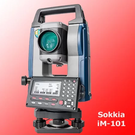
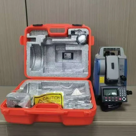
Sokkia iM-101 Total Station একটি উচ্চ নির্ভুলতার সার্ভেয়িং যন্ত্র, যা ভূমি জরিপ, নির্মাণ কাজ এবং ইঞ্জিনিয়ারিং মাপজোকের জন্য ব্যবহৃত হয়। এতে ১ সেকেন্ড অ্যাঙ্গেল একুরেসি থাকায় দূরত্ব ও কোণ নির্ভুলভাবে পরিমাপ করা যায়। এটি টেকসই, সহজে ব্যবহারযোগ্য এবং বিভিন্ন ফিল্ড কন্ডিশনে নির্ভরযোগ্য পারফরম্যান্স প্রদান করে। ফলে এটি পেশাদার সার্ভেয়ার ও ইঞ্জিনিয়ারদের জন্য একটি আদর্শ সমাধান।
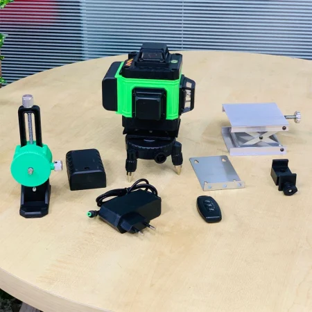
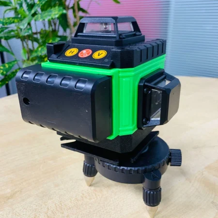
Laser auto leveling machine একটি আধুনিক লেভেলিং টুল যা কনস্ট্রাকশন ও ইন্টেরিয়র কাজে নির্ভুল লাইন ও অ্যালাইনমেন্ট নিশ্চিত করে। এটি self-leveling প্রযুক্তির মাধ্যমে দ্রুত সেটআপ করা যায় এবং কাজের গতি ও নির্ভুলতা বৃদ্ধি করে।
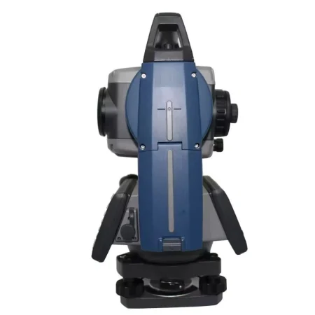
Total Station
- Model : Sokkia- iM 52
- Accuracy :: 2″ Second Accuracy
- Brand : Sokkia
- Manufacturer Country :: Japan
- Country of origin :: Japan
What we offer with every product:
- One Pieces Sokkia – Total station Triad
- One Big prism
- One big prism pole
- One Small Prism
- One Small prism polo
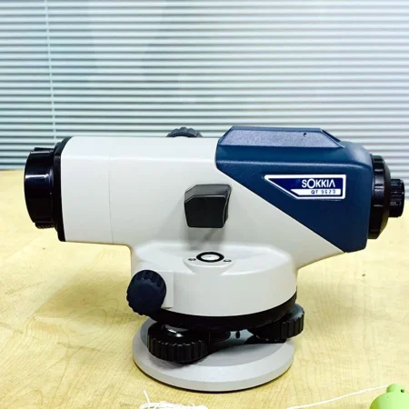
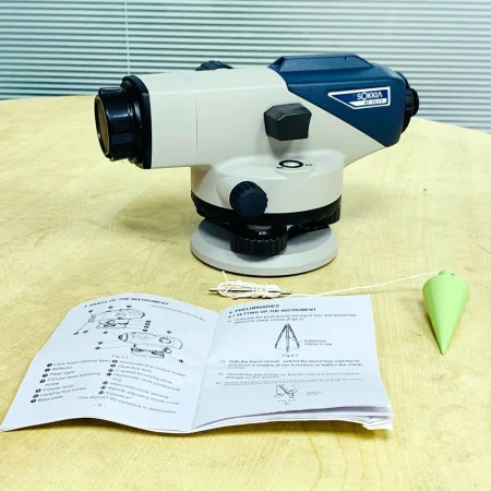
Best Quality Auto leveling Machine
- Brand : Sokkia
- Model : B20
- Manufacturing : China
- Country of origin: Japan
What we offer with every product:
- One Pieces – Auto Leveling Triad
- 5 meter Leveling Staff
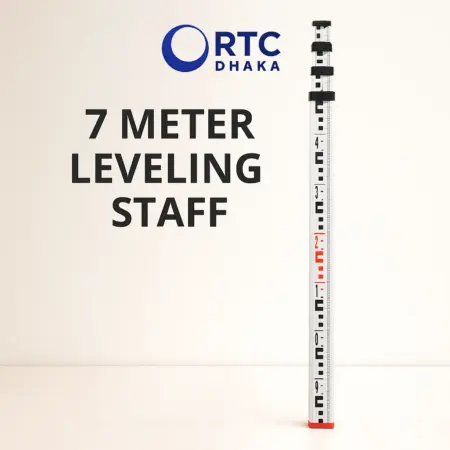
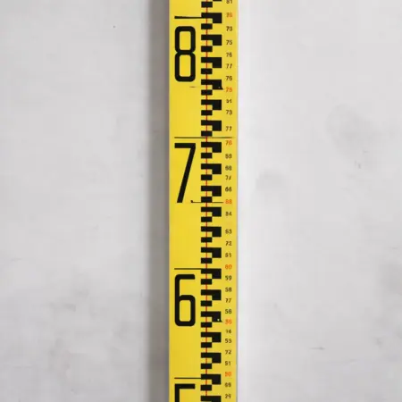
Size: 7meter or 23ft
5 folded system
Made of Aluminum Alloy
Country of Origin: China
Use : Many type of Surveying work. Mainly rive water surveying
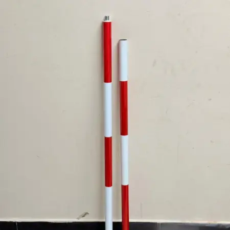
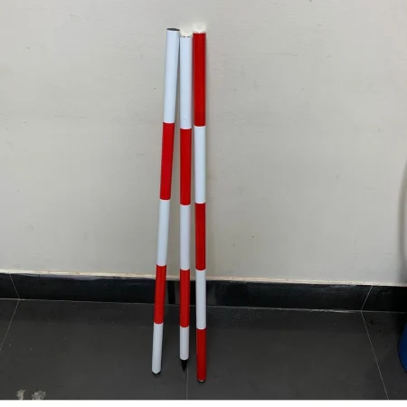
Surveying Ranging Rod ভূমি জরিপের সময় সরল রেখা নির্ধারণ ও নির্দিষ্ট পয়েন্ট চিহ্নিত করার জন্য ব্যবহৃত হয়। এটি শক্ত স্টিল দ্বারা তৈরি এবং লাল-সাদা রঙের স্পষ্ট দাগ থাকায় দূর থেকেও সহজে দেখা যায়। নিচের দিকে তীক্ষ্ণ ধাতব পয়েন্ট থাকায় মাটিতে সহজে স্থাপন করা যায়। ব্র্যান্ড: RTCDHAKA, উৎপাদন: China।